A Virtual Field Trip!!!- Learning Goals


Hello 7th Graders! Today we will be taking a virtual trip to 8 South American countries that contain the Amazon River Basin, also known as the Amazon Rainforest! The Amazon Rainforest is the world’s largest rainforest and you will be researching the 8 countries that contain the Amazon Rainforest. The 8 South American countries are Bolivia, Brazil, Colombia, Ecuador, Guyana, Peru, Suriname and Venezuela. The Amazon is made up of a mosaic of ecosystems and vegetation types including rainforests, seasonal forests, flooded forests, and savannas. Before you begin your amazing trip, you have to read these learning goals and watch the video provided on this page, in order to know what you will be learning at the 8 stops and to see what kind of species live in the Amazon Rainforest. Take a moment to watch the video at the bottom of the page and then continue reading the learning goals.

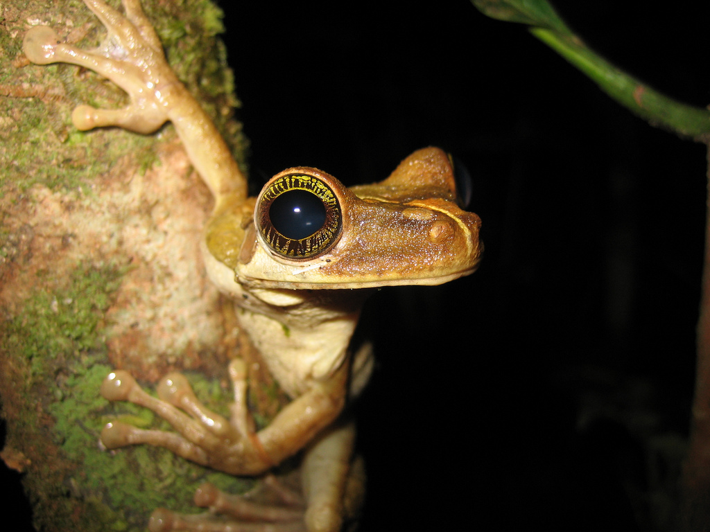
Now that you have watched the video, here is what you need to learn about each country you stop at. For each country you must answer the following questions: 1. Describe what you see in the pictures on each stop. 2. How much of this country contains the Amazon Rainforest? 3. Name a specie of plants, birds, amphibians, mammals or reptiles that live in this country and describe what they look like? 4. What is the annual deforestation rate of this country? 5. Why is the Amazon Rainforest disappearing in this country (list two reasons)? 6. What do you think should be done about the vast amount of forest disappearing in each country? 7. Do you think the government should protect the Amazon Rainforest in this country, why or why not? I have provided quotations from a few websites that will help you with the questions. Please provide three to four sentences for each question.

These questions will help you learn why the Amazon Rainforest is so important and why we need to protect it from deforestation. I want you to be able to answer the questions I provided you in complete sentences and show that you understood the content of the subject. My goal is for you to be able to analyze the information provided and formulate your own opinion based on the information given. Once you have answered all of these questions and visited the 8 South American countries, check out, “Wait there is more… Materials Referenced”, which includes the websites I used to provide you with information about the Amazon. Then read “Websites- Additional Information on the Amazon”; providing you with a list of six additional websites and descriptions that you can check out to learn more about the rainforest. Finally read, “XYZ- The End”, that reflects on your trip and includes incredible pictures from the Amazon Rainforest. Then write a short essay (2-3 pages) about what you learned in each country and include your opinion about what the government should do about the rainforest and why we should protect it.

Now that you have been informed about your exciting trip across South America, pack your bags and begin your virtual trip to the Amazon Rainforest!

Bolivia!!!


The map is a map of Bolivia, which includes the cities of Bolivia. I want to show you this picture because I want you to become familiar with Bolivia’s cities and where they are located. The other picture shows a type of insect living in the Bolivian Amazon Rainforest, which will help you with question one and three. The last picture shows the Amazon River Basin and the plant life around it.

Here is some information that will help you with the questions.

According to http://rainforests.mongabay.com/20bolivia.htm, “Bolivia has substantial rainforest cover in its lowland areas: the
Bolivian Amazon covers 229,985 square miles (59.6 million hectares) of which roughly two-thirds is forested. About half of Bolivia's forest cover consists of primary forest.”

“From 1986-1990, the country had a low deforestation rate—about 0.2 percent annually.”

“Greater threats to Bolivia's forests come from oil and gas development, commercial agricultural expansion, subsistence agriculture and fuel wood collection, and land-clearing for cattle pasture. In 2005, fires set for land clearing burned out of control during the record Amazon drought. All told, some 500,000 hectares of forest and pastureland went up in smoke. Agricultural fires are likely to worsen in the future as population pressures mount and the Amazon region experiences drier conditions due to climate change.”

Finish your questions and let’s move onto the next country! Brazil here we come!

Brazil!!!


The map is a map of Brazil and shows Brazil’s cities. I included this picture because I want you to know Brazil’s cities and where they are located. The other picture is a type of frog that lives in the Brazil Amazon Rainforest. This will help you with question one and three. The last picture depicts a stream running through the Amazon. It includes plant life and a large tree that must have fallen down at some point.

Here is some additional information that will help you with the questions.

According to http://rainforests.mongabay.com/20brazil.htm, “Brazil holds about one-third of the world's remaining rainforests, including a majority of the Amazon rainforest. It is also overwhelmingly the most bio-diverse country on Earth, with more than 56,000 described species of plants, 1,700 species of birds, 695 amphibians, 578 mammals, and 651 reptiles.”

“Due to the vastness of the Amazon rainforest, Brazil's average loss of 34,660 square kilometers of primary forest per year between 2000 and 2005 represents only about 0.8 percent of its forest cover. Nevertheless, deforestation in Brazil is one of the most important global environmental issues today.”

“In many tropical countries, the majority of deforestation results from the actions of poor subsistence cultivators. However, in Brazil only about one-third of recent deforestation can be linked to "shifted" cultivators. A large portion of deforestation in Brazil can be attributed to land clearing for pastureland by commercial and speculative interests, misguided government policies, inappropriate World Bank projects, and commercial exploitation of forest resources. For effective action it is imperative that these issues be addressed. Focusing solely on the promotion of sustainable use by local people would neglect the most important forces behind deforestation in Brazil.”

Finish your questions and let’s move onto the next country! Colombia here we come!

Colombia!!!


The first picture, the map of Colombia, includes the cities of Colombia. I included this picture because I want you to become familiar with Colobia’s cities and be able to locate them on a map. The other picture shows a type of monkey that lives in Colombia’s Amazon Rainforest. This picture will help you with question one and three. The last picture shows a seasonal forest of the Colombia Amazon Rainforest and a type of mammal that lives there.

Here is some additional information that will help you answer the questions.

According to http://rainforests.mongabay.com/20colombia.htm, “Despite its relatively small size, Colombia is the second most biologically diverse country on Earth, home to about 10 percent of the world's species. This biodiversity results from Colombia's varied ecosystems—from the rich tropical rainforest to the coastal cloud forests to the open savannas. More than 1,821 species of birds, 623 species of amphibians, 467 species of mammals, 518 species of reptiles, and 3,200 species of fish reside in Colombia. About 18 percent of these are endemic to the country. Colombia has a mind-boggling 51,220 species of plants, of which nearly 30 percent are endemic. While on paper nearly 10 percent of Colombia is under some form of protection, its rich biodiversity is increasingly threatened.”

“Each year Colombia loses nearly 200,000 hectares of natural forest, according to figures released by the United Nations in 2003—though the true figure may be higher since an estimated 100,000 hectares of native forest are illegally cleared every year. The vast majority of this loss is primary forest, which covers more than 80 percent of the country. Deforestation in Colombia results primarily from small-scale agricultural activities, logging, mining, energy development, infrastructure construction, large-scale agriculture, and the cocaine trade. Animal collection and pollution are also environmental issues in the country.”

“Colombia's Pacific Coast rainforests are rapidly disappearing due to gold mining and palm-oil plantations. By one estimate, in the mid-1990s, industrial gold mining alone cleared 80,000 hectares of forest per year, while contaminating local rivers with mercury and siltation. Coca production is also expanding in this region.”

Finish your questions and let’s move onto the next country! Ecuador here we come!

Ecuador!!!


The map is a map of Ecuador that includes the cities of Ecuador. I provided a map of Ecuador because I want you to be familiar with its cities when you are traveling in the country. The next picture shows a small type of leopard that lives in Ecuador’s Amazon Rainforest. The small leopard appears to be calling for someone. The last picture shows a small waterfall that feeds into a stream or river and is surrounded by a seasonal forest in the Amazon.

Here is some helpful information that will help you with the questions.

According to http://rainforests.mongabay.com/20ecuador.htm, “Despite its small area, Ecuador is the eighth most bio-diverse country on Earth. Ecuador has almost 20,000 species of plants, over 1,500 species of birds, more than 840 species of reptiles and amphibians, and 341 species of mammals.”

“Ecuador also has the distinction of having the highest deforestation rate and worst environmental record in South America. Oil exploration, logging, and road building have had a disastrous impact on Ecuador's primary rainforests, which now cover less than 15 percent of the country's land mass.”

“Logging in Western Ecuador (coastal and low Andean) areas is responsible for the loss of 99 percent of the country's rainforest in this region. Historically, after an area has been selectively logged and abandoned, settlers follow logging roads and set up homesteads, slashing and burning the surrounding forest for agriculture and cattle pasture.”

Finish your questions and let’s move onto the next country! Guyana here we come!

Guyana!!!


The map is a map of Guyana and Guyana’s major cities. I provided a map of Guyana because when you are traveling to a foreign country, you should know where you are and where you are going. The other picture shows a family of monkeys that live in Guyana’s Amazon Rainforest. It appears to be a mother, father and child. The last picture shows a large waterfall surrounded by various plants and wild life.

Here is more information to help you answer the questions.

According to http://rainforests.mongabay.com/20guyana.htm, “Guyana is a small, lightly populated country on the north coast of South America. About three-quarters of Guyana is forested, roughly 60 percent of which is classified as primary forest. Guyana's forests are highly diverse: the country has some 1,263 known species of amphibians, birds, mammals, and reptiles, and 6,409 species of plants. According to an assessment by the ITTO, forests in Guyana can be broken down as follows: rainforest (36 percent), montane forest (35 percent), swamp and marsh (15 percent), dry evergreen (7 percent), seasonal forest (6 percent), and mangrove forest (1 percent).”

“Despite its forest cover, Guyana's ancient soils are highly infertile and most of the country's population of 765,000 is confined to coastal areas. Guyana is one of South America's poorest countries and carries an external debt that is 40 percent of its GDP.”

Finish your questions and let’s move onto the next country! Peru here we come!

Peru!!!


The map is a map of Peru and it cities. I provided a map of Peru because I think you should know the cities in the country you are traveling, so you don’t get lost and you know exactly where you are. The next picture shows a type of bird resting on a tree in the rainforest. The bird has many different colors. The last picture shows the Amazon River Basin running through a heavily forested area in Peru. Many trees and many plants surround the basin.

Here is additional information that will help you answer the questions.

According to http://rainforests.mongabay.com/20peru.htm, “Peru has the third largest extent of tropical rainforests in the world, after Brazil and the Democratic Republic of Congo. These forests are some of the richest in the world, both in terms of biological diversity and natural resources (timber, energy, mineral resources).”

“About half of Peru is forested. Of this, more than 80 percent is classified as primary forest. The FAO estimates that the country loses somewhere between 224,000 and 300,000 hectares of forest per year, giving it an annual deforestation rate of 0.35-0.5 percent, a low rate relative to neighboring countries. Most of this deforestation is the result of subsistence agriculture, which can largely be attributed to the migration of farmers from the highlands taking advantage of Peru's land-tenure law which allows people to own land by occupying it for five years.”

“Deforestation and degradation are also increasingly the result of development activities, especially logging, commercial agriculture, mining, gas and oil operations, and road construction.”

Finish your questions and let’s move onto the next country! Suriname here we come!

Suriname!!!


The map is a map of Suriname and its major cities. I included this map because you should become familiar with Suriname’s cities while traveling here. The next picture shows a type of lizard that lives in Suriname’s Amazon Rainforest. The last picture shows a nighttime view of the Amazon River Basin that runs through Suriname. There are a couple canoes to the right of the picture.

According to http://rainforests.mongabay.com/20suriname.htm, “Suriname's extensive forest cover and low population, about 400,000 concentrated in the capital and coastal cities, give it one of the lowest deforestation rates in the world. Only 5 percent of the population lives in the rainforest; this includes indigenous peoples and six tribes of Maroons—descendants of escaped slaves who recreated forest communities centuries ago and today retain their traditional West African style (ironic since West Africa's rainforests are depleted). Conflicts between the coastal population and the natives of the forested interior manifested themselves in a bloody six-year civil war that was resolved in 1992 with the signing of a peace treaty. Under the treaty, the interior and indigenous populations have the right to their indigenous lands and to control economic activity on those lands.”

“Despite being ranked by the World Bank as among the 17 potentially richest countries in the world, given its gold, oil, diamond, and other natural resources, Suriname in the early 1990s was in a dire economic situation. It had virtually no international trade, dilapidated industries, no foreign aid, and a budget with spending exceeding revenues by 150 percent.”

“By the mid-1990s, the government—desperate for cash—granted large concessions to foreign timber and mining interests. Some 25 percent of the country was put up for logging by Malaysian and Indonesian timber firms. The terms of the agreement, full of loopholes, granted forest land at less than $35 an acre ($262 m for 7.5 m acres). Analysis of the figures showed that while loggers stood to make more than US$28 million annually over the 25-year concession, Suriname would only earn get US$2 million per year. Further, according to forestry experts, the only profitable way to log regions in Suriname is by clear-cutting.”

Finish your questions and let’s move onto the final country! Venezuela here we come!

Venezuela!!!


The map is a map of Venezuela and its major cities. I included this map because I want you to be familiar with Venezuela’s cities while you are traveling in it. The next picture shows a large jaguar that lives in Venezuela’s Amazon Rainforest. The jaguar looks very hungry! The last picture shows a small stream that runs through a heavily forested area in the rainforest. Two people are riding in a canoe, maybe to catch some fish.

Here is some additional information that will help you to answer the questions.

According to http://rainforests.mongabay.com/20venezuela.htm, “Venezuela, one of the ten most bio-diverse countries on Earth, is home to extensive rainforests that are increasingly threatened by development. Each year, roughly 287,600 hectares of forest are permanently destroyed, while other areas are degraded by logging, mining, and oil extraction. Between 1990 and 2005, Venezuela officially lost 8.3 percent of its forest cover, or around 4,313,000 hectares.”

“[A] significant threat to the rainforests of Venezuela is the mining industry. Informal or wildcat gold and diamond miners are particularly active in the southern state of Bolivar where they have a history of violent conflicts with local indigenous people—including the Yanomani—as well as a role in the environmental degradation of the region through pollution of local rivers and deforestation. Over the past decades, successive Venezuelan governments have taken steps to control mining in the region but have made relatively little long-term progress and have made some questionable decisions like granting 40 percent of the 8.6-million-acre (3.4-million-ha) Imataca Reserve to industrial miners and loggers in 1997.”

You are done traveling the 8 South American countries! Finish up your questions and lets head home! Once you are home, read “Wait there is more… Materials Referenced”, which includes the websites I used to provide you with information about the Amazon. Then read “Websites- Additional Information on the Amazon”; providing you with a list of six additional websites and descriptions that you can check out to learn more about the rainforest. Finally read, “XYZ- The End”, that reflects on your trip and includes incredible pictures from the Amazon Rainforest.

Materials Referenced!!!


Here is a list of all the websites I used to provide you with information about the Amazon Rainforest. It is very important to always cite the websites or books you used for information, so you don't plagiarize, or steal their work without giving the author or website credit.

1. http://rainforests.mongabay.com/amazon/
Butler, Rhett A. "The Amazon: The Largest Rainforest." The Amazon Rainforest. 1999-2009. Mongabay.com, Web. 1 Dec 2009.

2. http://www.youtube.com/watch?v=tq6N9bKwG5o
"An Introduction to the Amazon Rainforest." YouTube. Web. 1 Dec 2009.

3. http://rainforests.mongabay.com/20bolivia.htm
Butler, Rhett A. "The Amazon: The Largest Rainforest." The Amazon Rainforest. 1999-2009. Mongabay.com, Web. 1 Dec 2009.

4. http://rainforests.mongabay.com/20brazil.htm
Butler, Rhett A. "The Amazon: The Largest Rainforest." The Amazon Rainforest. 1999-2009. Mongabay.com, Web. 1 Dec 2009.

5. http://rainforests.mongabay.com/20colombia.htm
Butler, Rhett A. "The Amazon: The Largest Rainforest." The Amazon Rainforest. 1999-2009. Mongabay.com, Web. 1 Dec 2009.

6. http://rainforests.mongabay.com/20ecuador.htm
Butler, Rhett A. "The Amazon: The Largest Rainforest." The Amazon Rainforest. 1999-2009. Mongabay.com, Web. 1 Dec 2009.

7. http://rainforests.mongabay.com/20guyana.htm
Butler, Rhett A. "The Amazon: The Largest Rainforest." The Amazon Rainforest. 1999-2009. Mongabay.com, Web. 1 Dec 2009.

8. http://rainforests.mongabay.com/20peru.htm
Butler, Rhett A. "The Amazon: The Largest Rainforest." The Amazon Rainforest. 1999-2009. Mongabay.com, Web. 1 Dec 2009.

9. http://rainforests.mongabay.com/20suriname.htm
Butler, Rhett A. "The Amazon: The Largest Rainforest." The Amazon Rainforest. 1999-2009. Mongabay.com, Web. 1 Dec 2009.

10. http://rainforests.mongabay.com/20venezuela.htm
Butler, Rhett A. "The Amazon: The Largest Rainforest." The Amazon Rainforest. 1999-2009. Mongabay.com, Web. 1 Dec 2009.

Learn more about the Amazon on these Websites!!!

Here are some websites I recommend you check out to learn more about the Amazon Rainforest!

1. http://www.boliviabella.com/rainforest-wildlife.html

This website focuses on Bolivia and the Amazon Rainforest in Bolivia. It includes YouTube videos on the rainforest, like the types of animals that live there and why we should protect the rainforest. This website also includes pictures of Bolivia’s Amazon Rainforest and different wildlife. It includes rainforest vocabulary lists and provides informational facts about the Amazon Rainforest. You should check it out!

2. http://www.amazon-rainforest.org/

This website tells the readers their opinion on why we should save the rainforest. One of the reasons is because it is the largest rainforest in the world and inhabits many different kinds of wildlife. This website also includes an essay about why the rainforest is so important and various facts about the Amazon.

3. http://www.eduweb.com/amazon.html

This website lets you explore the geography of the Ecuadorian rainforest through online games and activities. It provides information about the Quichua people who live in the Amazon Rainforest and how they make their living. The online games are a lot of fun!

4. http://sevennaturalwonders.org/south-america/amazon-rainforest

This website includes an article about the fact that the Amazon Rainforest might be declared a notable wonder of South America. It includes pictures and basic facts about the Amazon Rainforest.

5. http://leslietaylor.net/gallery/gallery.htm

This website includes a photo gallery of Amazon wildlife, the indigenous tribes of the Amazon, life in the rainforest, images of destruction, rivers, streams, waterfalls, and trees. The pictures are really cool!

6. http://www.pbs.org/journeyintoamazonia/explorer.html

“What mysteries does Amazonia hold? That's just what scientists at the American Museum of Natural History want you, Sam Smith, find out. If you're ready to explore the wilds of the Amazon jungle, journey on, adventurer!” This website includes a game you can play called “Amazon Explorer”, where you can explore different aspects about the Amazon.

The End- Reflections!!!


Wow! What an amazing trip!! I hope you had fun exploring the 8 South American countries that contain the Amazon Rainforest. For the perfect ending to the perfect trip, watch this video on the bottom of the page, on a variety of wildlife that lives in the Amazon. Also, check out the pictures from the Amazon!

I hope you learned a lot about the Amazon Rainforest! Now write a short essay (2-3 pages) about what you learned in each country and include your opinion about what the government should do about the rainforest and why we should protect it. Thank you for going on the virtual trip and I can't wait untill we go on another one!